You Sail. We'll do the rest.

Join 1 Million+ marine users worldwide

John and Lyn Martin
Cruising Sailors
“Intelligent, accurate, easy to use and always puts you in the right place to take best advantage of the systems.”

Ed Gorman
Sailing Correspondent, The Times, 1996-2006
“Completely reliable, an essential part of the daily routine onboard.”

Annie Gardner
Olympic Silver Medalist, 5 x World Titles
“It’s been said “knowledge is power” and PredictWind is a power tool!”

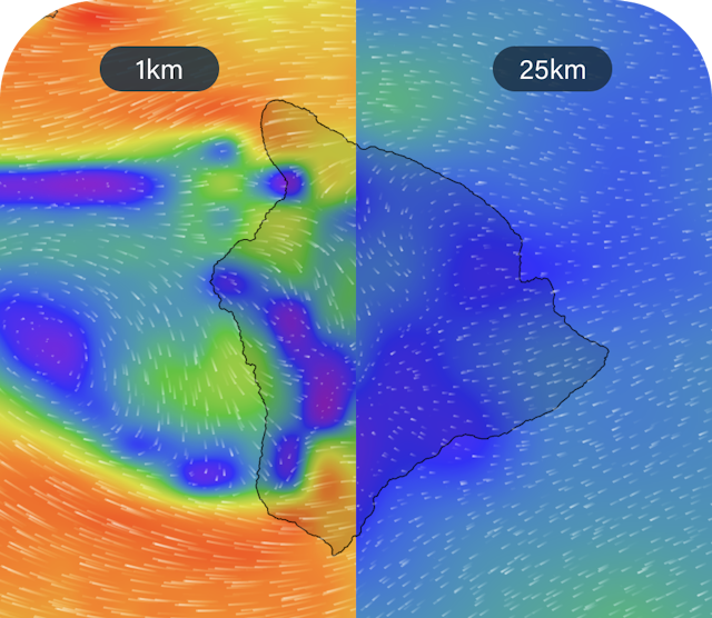
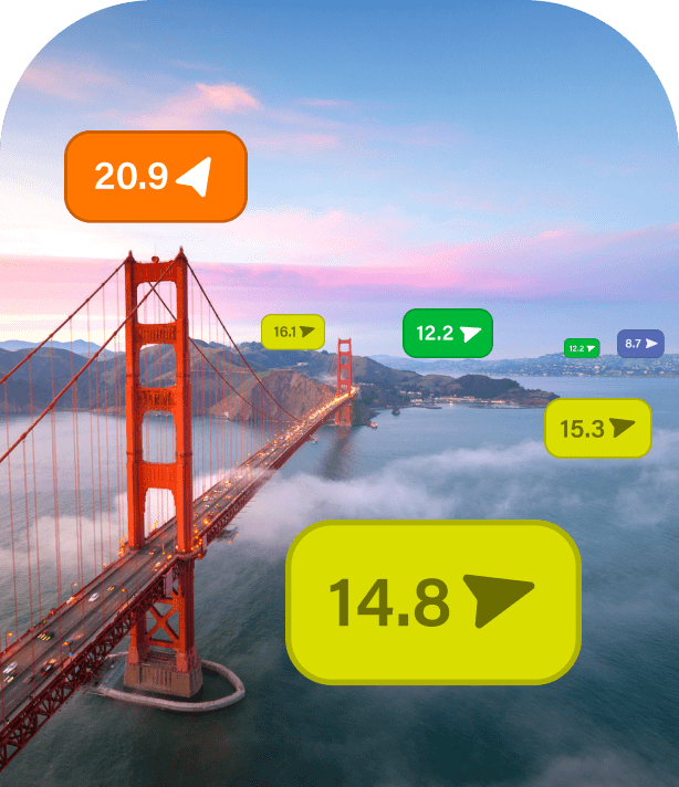
Hi-res Maps
Experience unrivalled accuracy and detail like never before. Select from our extensive range of forecasts below.
Unrivalled detail

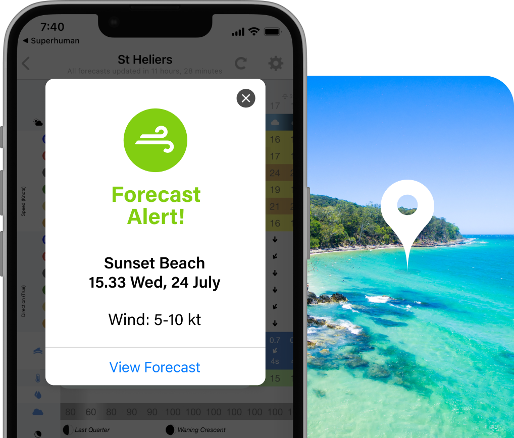
Get notified when conditions are perfect
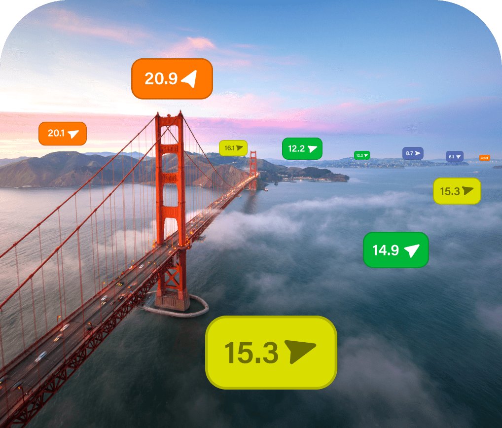
Understand the ocean


Know before you head out
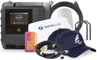
The ultimate setup for cruisers.
Here is all the gear and services you need to stay safe and connected on your next passage.


Efficient routes, every time
Set your start and end points and Weather Routing plots an optimised route through the wind, waves and current for safety, speed or comfort.
View the Technical Report for more info.
Find out more

Perfect weather more often


Get on the water with less admin
Day 1
Day 2
Optimal
Departure
Day 3
Day 4

Day 1
Day 2
Optimal
Departure
Day 3
Day 4

Learn from the locals


Pricing
and Subscriptions
Yearly
3 Monthly

"It’s been said “knowledge is power” and PredictWind is a power tool!"
Annie Gardner
Olympic Silver Medalist, 5 x World Titles

"Completely reliable, an essential part of the daily routine onboard."
Ed Gorman
Sailing Correspondent, The Times, 1996-2006

"Intelligent, accurate, easy to use and always puts you in the right place to take best advantage of the systems."
John and Lyn Martin
Cruising Sailors
Please reach out to our Support team or visit the Help Centre if you have any questions.