About Port Elgin Harbour
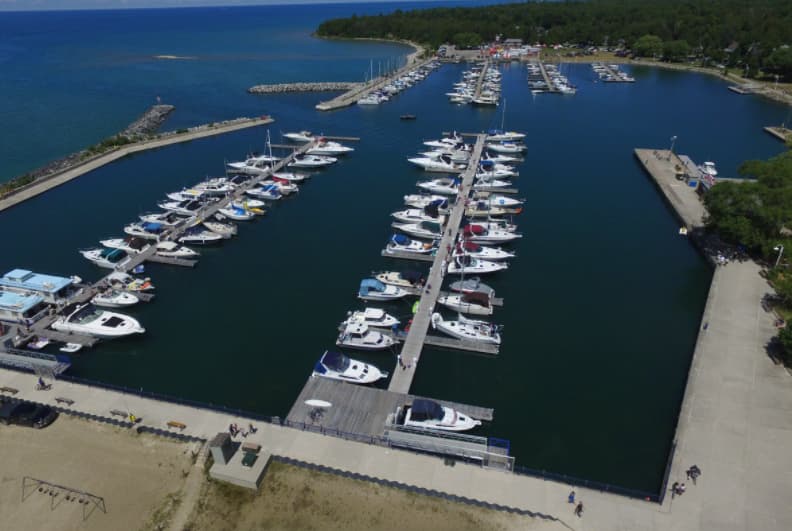
Port Elgin Harbour is located 4 miles south of Southampton marked by Chantry Island lighthouse and approximately 10 miles north of Bruce Nuclear Power Development. Port Elgin Harbour is a municipally run marina offering both seasonal and transient slips to boaters. The harbour acts as a gateway to Saugeen Shores for our visiting boaters and a home away from home to our seasonal occupants. Logie's Rock serves as an excellent reference point to enter the harbour. It is marked by a light buoy and lies 2 miles west-northwest of Port Elgin. It is important to stay within the buoyed channel when entering the harbour. Range markers with green lights lead boaters in on a course of 109. The channel depth is 10-14 feet from chart datum, but outside of the channel it quickly shallows to as little a 2 feet.
Einrichtungen
 Strom
Strom BenzinDiesel
 Wasser
 Duschen
 Abwasser
 Toiletten
 Essen
Essen Bar
BarPort Information
Telefon
Berth Sizes
Tiefe bei MLW
Manövrierbarkeit
Channel Marking
Overseas Visitor Berths
Katamaran-Liegeplätze
Stegart
Style Side To
Style Stern To
Tidal Flow
Active Winter
Weather Forecast
 N 7–12 knots. Gusts up to 23 knots.
 Increasing from 16 to 19°C
 N 0.7m at 3s period
 UV Index: 0 - Low
 Sunny
Sunny
- N 12 knots. Gusts up to 18 knots.
- Increasing from 20 to 23°C
- N 0.7m at 3s period
- UV Index: 7 - High
- Sunny
- NW 11–13 knots. Gusts up to 19 knots.
- 21 to 24°C
- NW 0.6m at 3s period
- UV Index: 7 - High
- Sunny