
- Designed for wifi or mobile data
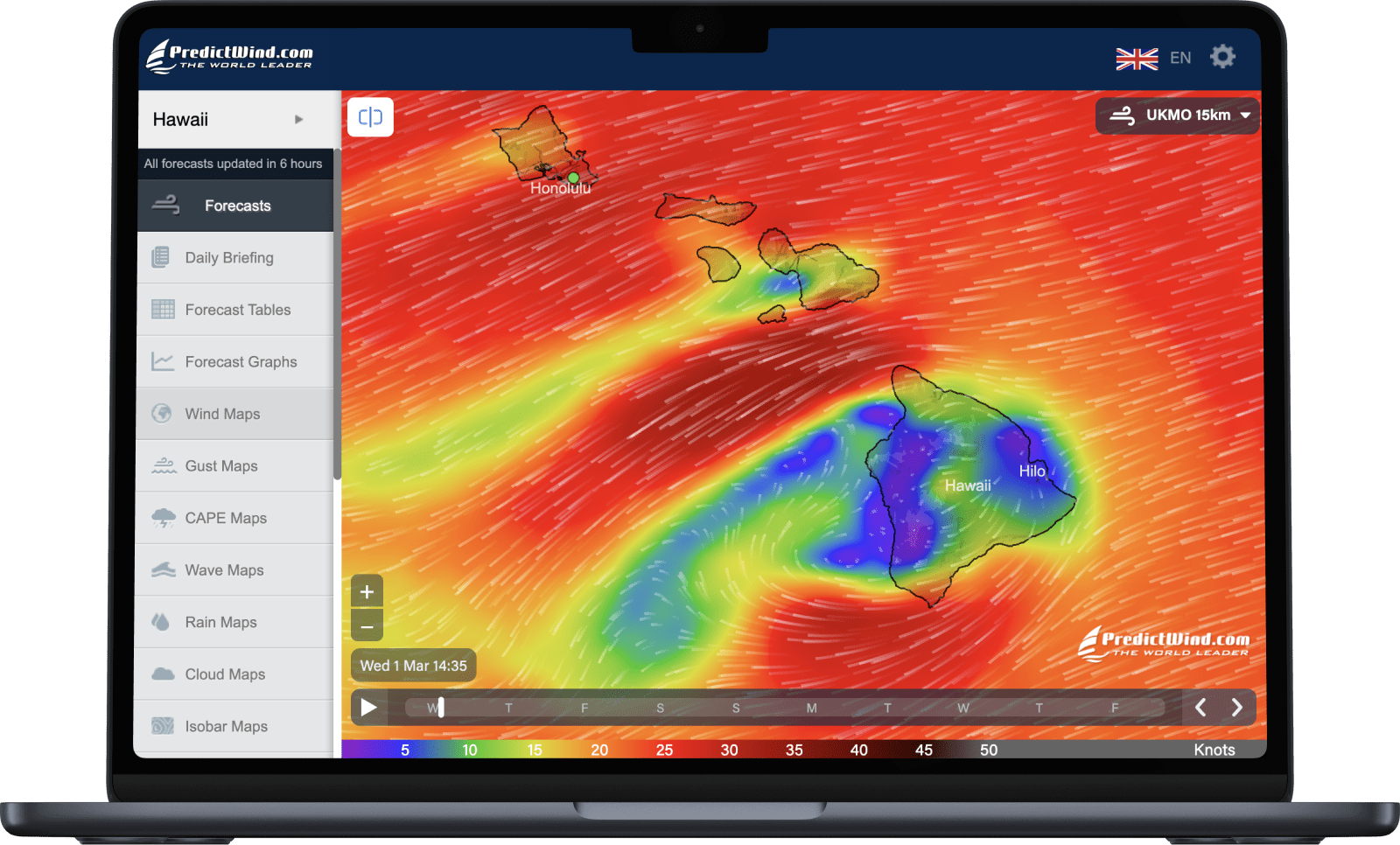
- High resolution forecasts
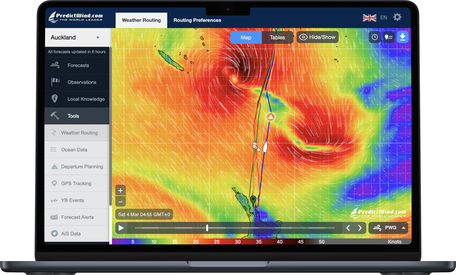
- Powerful marine tools
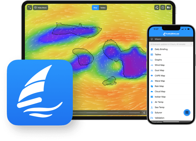
- Access on any device
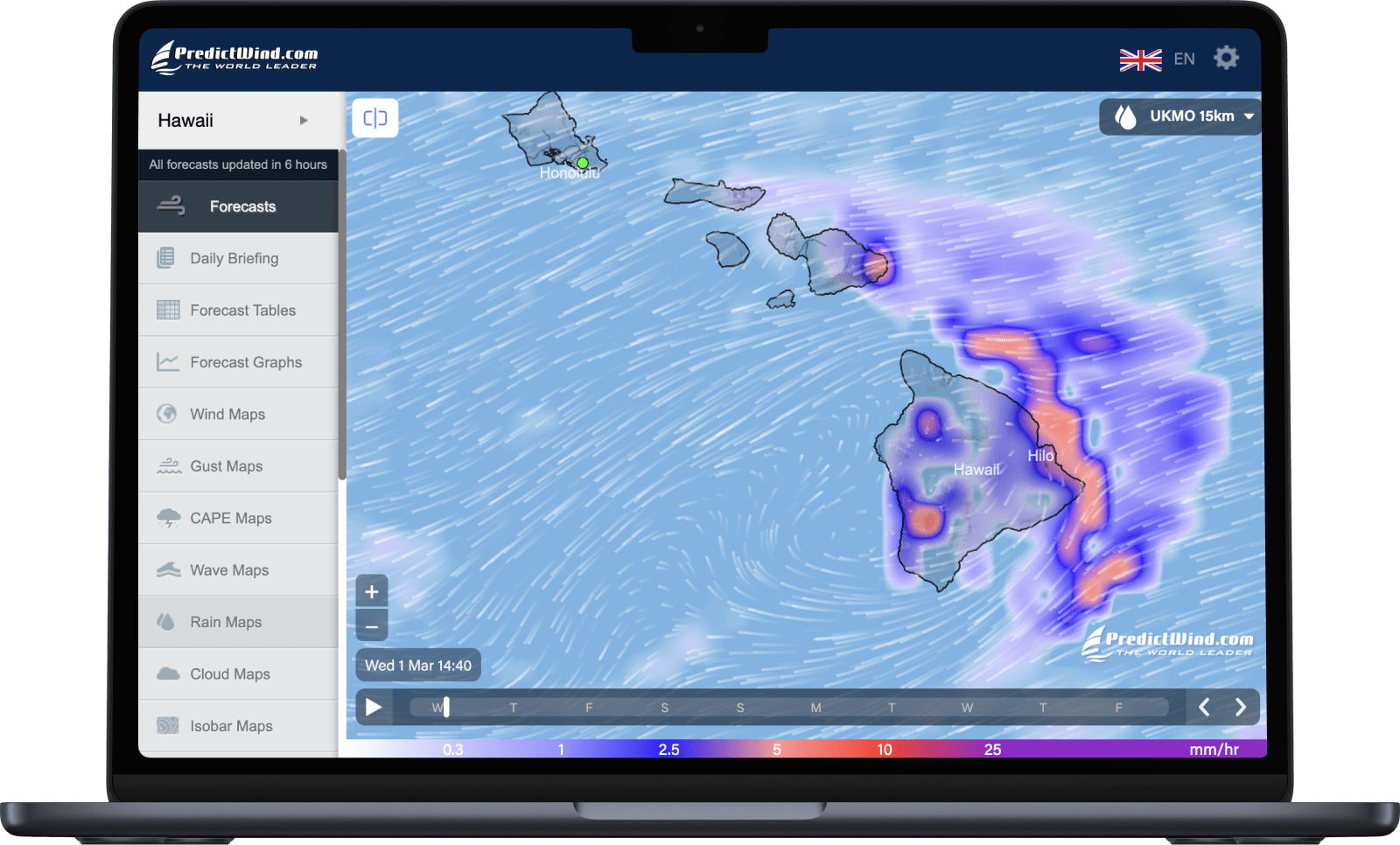
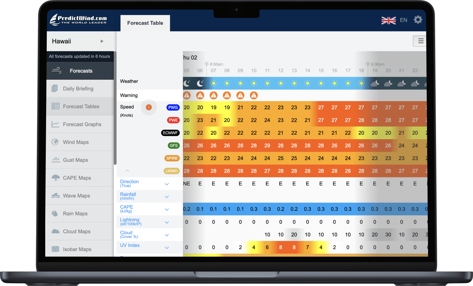
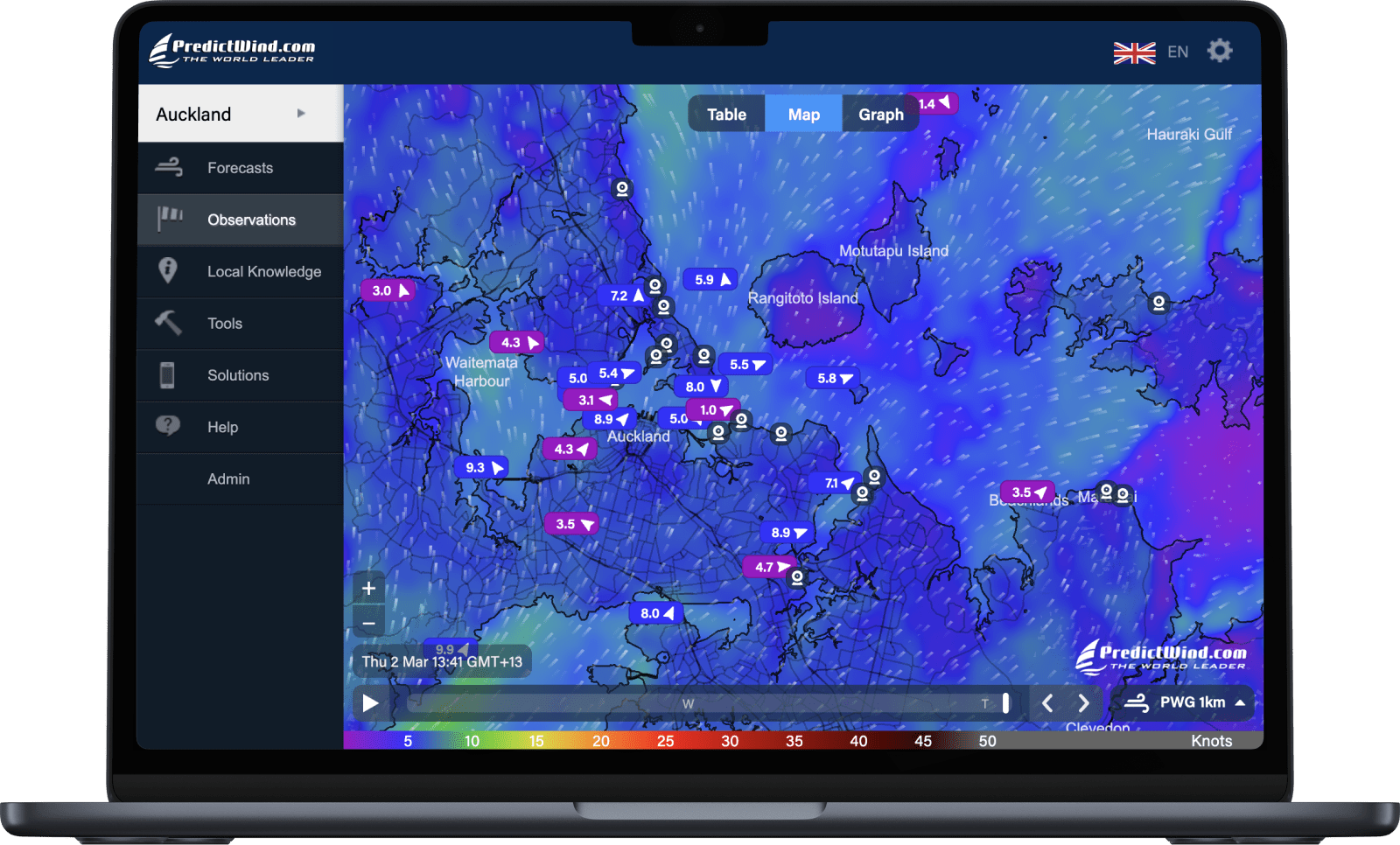
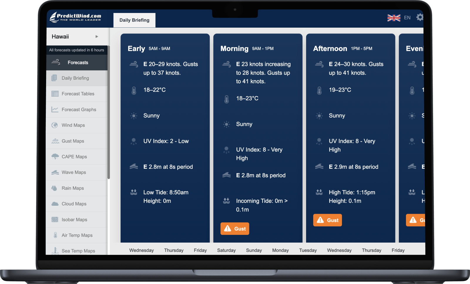
- Forecast maps, tables and graphs

The PredictWind App and Website are designed for use on cellular and wifi networks. View high resolution forecasts on your mobile, tablet or computer.
Available on iOS and Android.

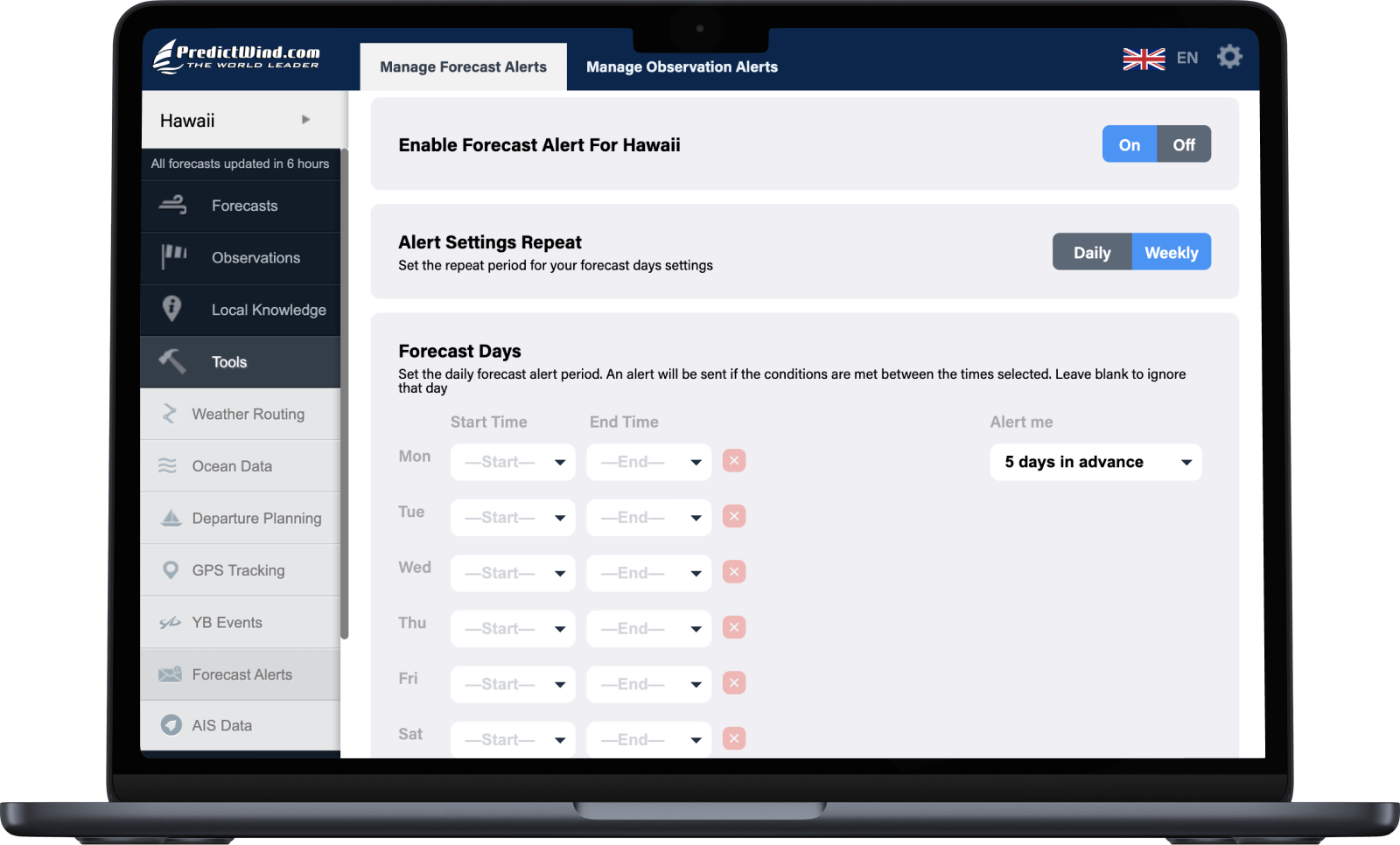
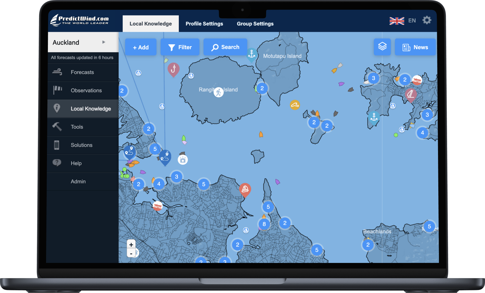
Save locations
Each day is divided into four periods - early morning, morning, afternoon and evening.

View data your way
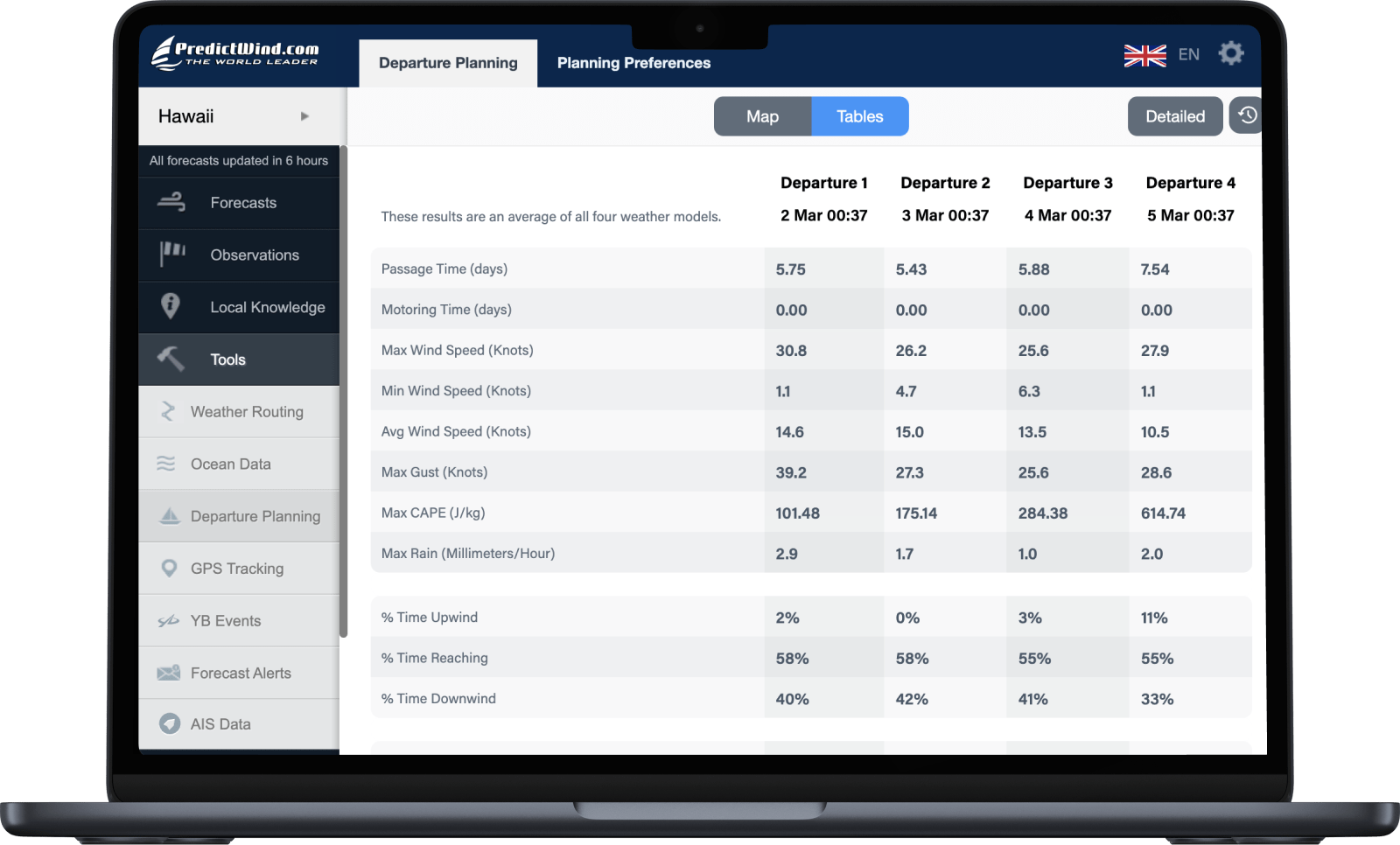
Choose to view the forecasts as Maps, Graphs or Tables. Compare all three or stick with your favourite.

Increased accuracy
High resolution forecasts down to an incredible 1km resolution, give you greater detail and accuracy.

Forecast confidence
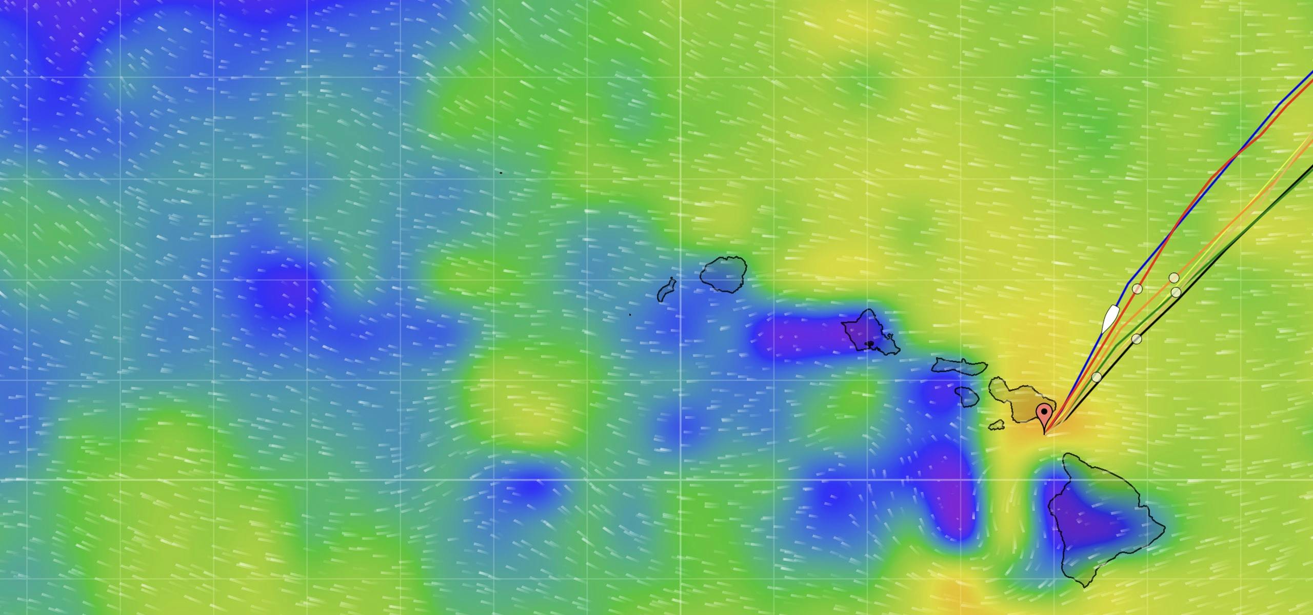
Compare all of our weather models: ECMWF, SPIRE, UKMO, GFS, PWG, PWE plus more regional models.

All the tools you need
Powerful marine tools make your time on the water safer, easier and a lot more enjoyable.

Outstanding customer support
Our support team of experienced sailors and marine experts get you the help you need, fast.
Forecasts
Tools
ProductsIridium PhonesPredictWind AppOffshore AppClothingIridium GO! execIridium GO!DataHubYB3iGRIB FilesSIM CardsSIM Airtime PlansAnyApp DataActivate SIM/DevicePredictMailPredictChatStarlinkOver the Horizon AIS
FeaturesWeather RoutingPower RoutingDeparture PlanningCurrent ModelsGPS TrackingMapsDaily BriefingGraphs/TablesWeather ModelsAlertsObservationsLocal KnowledgeValidationAIS DataAI Polars
Products
Features
Choose your Activity
Support