About Smugglers Cove Marina
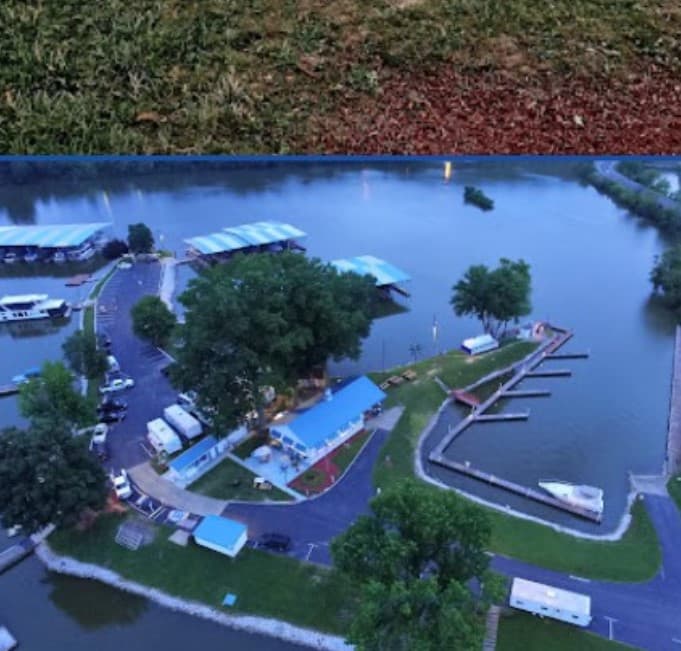
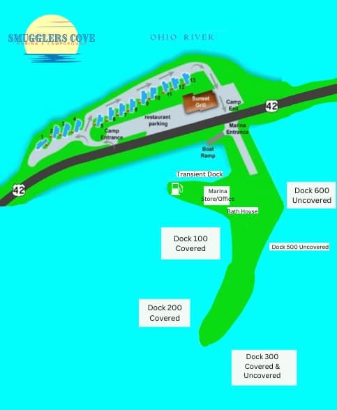
38.77126° N, 84.93085° W A little prudence is required. At maximum low tide, about ten feet back from the water's edge. At mile 530, the left descending bank of the river enters Craig's Creek on the Kentucky side. (Approximately 2 miles upriver from Markland Damn) Keep your pace in check and center the entrance on the bridge. It's roughly six feet deep. Proceed to the port after crossing the bridge, which is approximately 1/8 mile. Marine is straight ahead on your left. At mean low tide, the bridge clearance is 22 feet. The water is eight feet deep. The general maximum flood level is called the tide value.

Einrichtungen
 Strom
Strom BenzinDiesel
 Wasser
 WLAN
WLAN Duschen
 Toiletten
 Recycling
 Essen
Essen Bar
Bar Bootsbauer
 Supermarkt
COORDINATES
38.77137 N, 84.93051 W
Port Information
Telefon
Berth Sizes
< 10m, 10-20m
Tiefe bei MLW
2 - 3m
Manövrierbarkeit
Fair
Channel Marking
Excellent
Einreisehafen
No
Overseas Visitor Berths
Yes
Stegart
Floating
Style Side To
Yes
Tidal Flow
Beware
Active Winter
Yes
Weather Forecast
Tue
5AM - 9AM
28 July 2026
 SW 4–8 knots. Gusts up to 20 knots.
 22 to 24°C
 UV Index: 0 - Low
 Chance of showers
Tue
9AM - 1PM
28 July 2026
- W 7–9 knots veering NW 7-9 knots. Gusts up to 18 knots.
- 24 to 28°C
- UV Index: 8 - Very High
- Cloudy
Tue
1PM - 5PM
28 July 2026
- NW 7–10 knots.
- 26 to 29°C
- UV Index: 9 - Very High
- Cloudy