Use uma subscrição Professional para tomar decisões meteorológicas mais inteligentes
O que está a acontecer?
- Modelos de alta resolução
- Comparação lado a lado
- Estações meteorológicas em direto
- E muito mais...
O que deve fazer o meu barco?
- Weather Routing
- Departure Planning
- AI Polars (com DataHub)
- Modelação do barco
- E muito mais...
Como está a correr o plano?
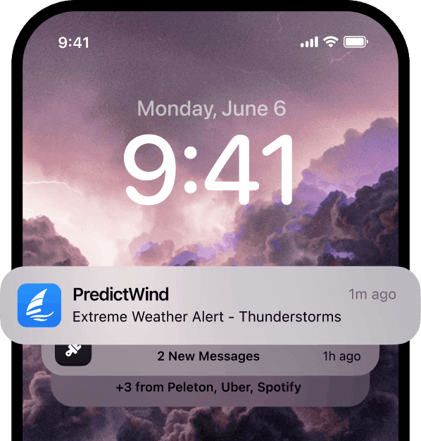
- Avisos de tempo extremo
- Dados AIS globais
- E muito mais...
Análise meteorológica complexa tornada fácil
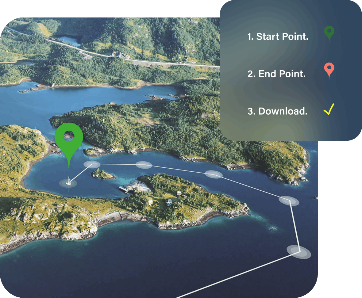
Não perca horas a traçar uma rota e a verificar previsões para garantir uma passagem segura. As ferramentas Weather Routing e Departure Planning da PredictWind tratam do trabalho pesado para lhe dar a rota e a janela de partida perfeitas, em segundos.
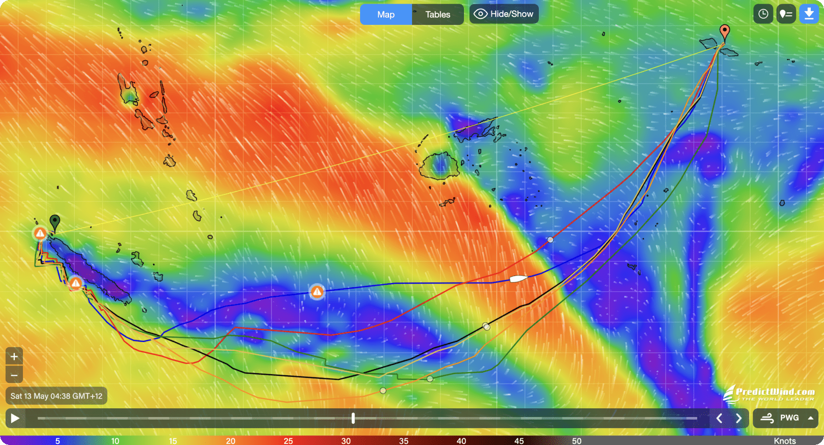
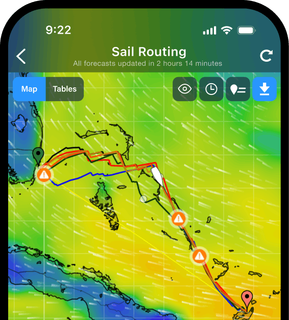
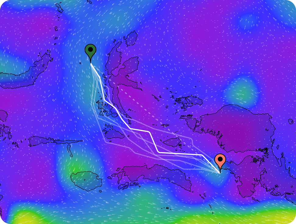
A melhor rota sempre
PredictWind Weather Routing calcula a sua rota para evitar mar agitado, ventos fortes, terra e águas rasas, garantindo uma passagem segura e eficiente.
Cada rota é calculada usando dados de previsão da mais alta resolução. Veja e compare a rota de cada um dos 6 modelos para ter 100% de confiança na meteorologia.
Ver o Weather Routing Relatório técnico

Big data, small downloads
Our cloud-based Weather Routing accesses high resolution forecast data without needing to download it. We calculate your route, send it back to you on the boat and you’re away!
Save hours of download time and big data bills with your offshore internet connection by using PredictWind Weather Routing.
28 Day Forecasts
For longer routes and projections, Weather Routing uses the ECMWF Ensemble Forecast. This is currently the world’s most accurate long range forecast and will let you plan your trip well in advance, with better accuracy than traditional climate forecasts.

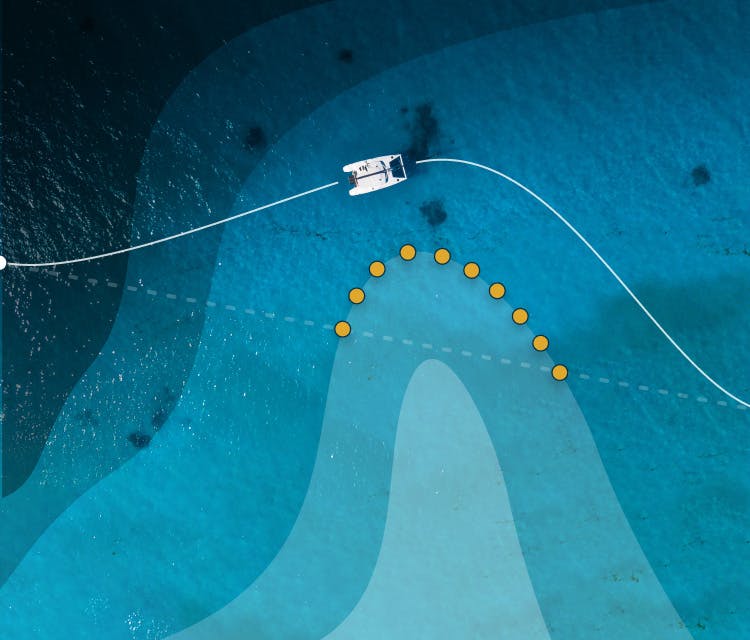
Wave Modelling
Enter your boat dimensions to activate advanced wave modelling. This feature uses 3D hydrodynamic modelling to calculate how your individual hull shape will interact with the forecasted wave conditions. This data is then included in your route calculations, resulting in the most accurate Weather Routing tool on earth.
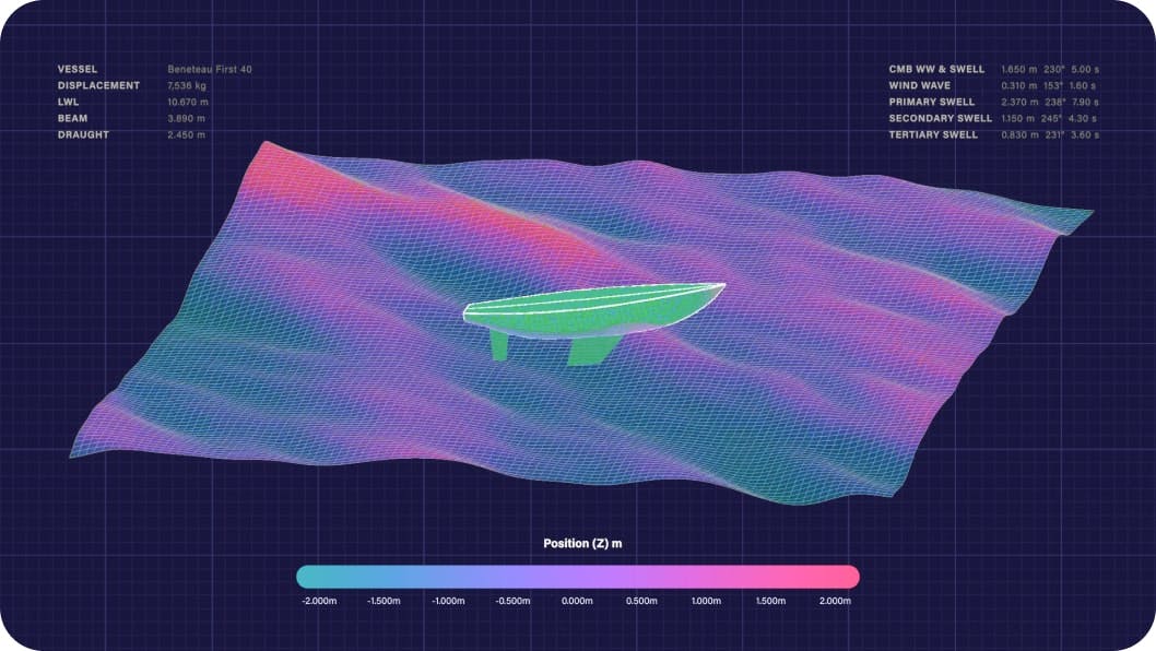
Know how your boat will fare
See roll, vertical acceleration and slamming incidence data along your entire route. Only available on Professional accounts.


Detailed sea state breakdown
The ocean surface can be affected by different wind waves and swells of varying sizes and directions. We calculate the above safety metrics using primary, secondary, tertiary swell, and wind wave data. These can be viewed as a combined output, or dig deeper to look at each swell layer individually.
WARNINGHigh Winds
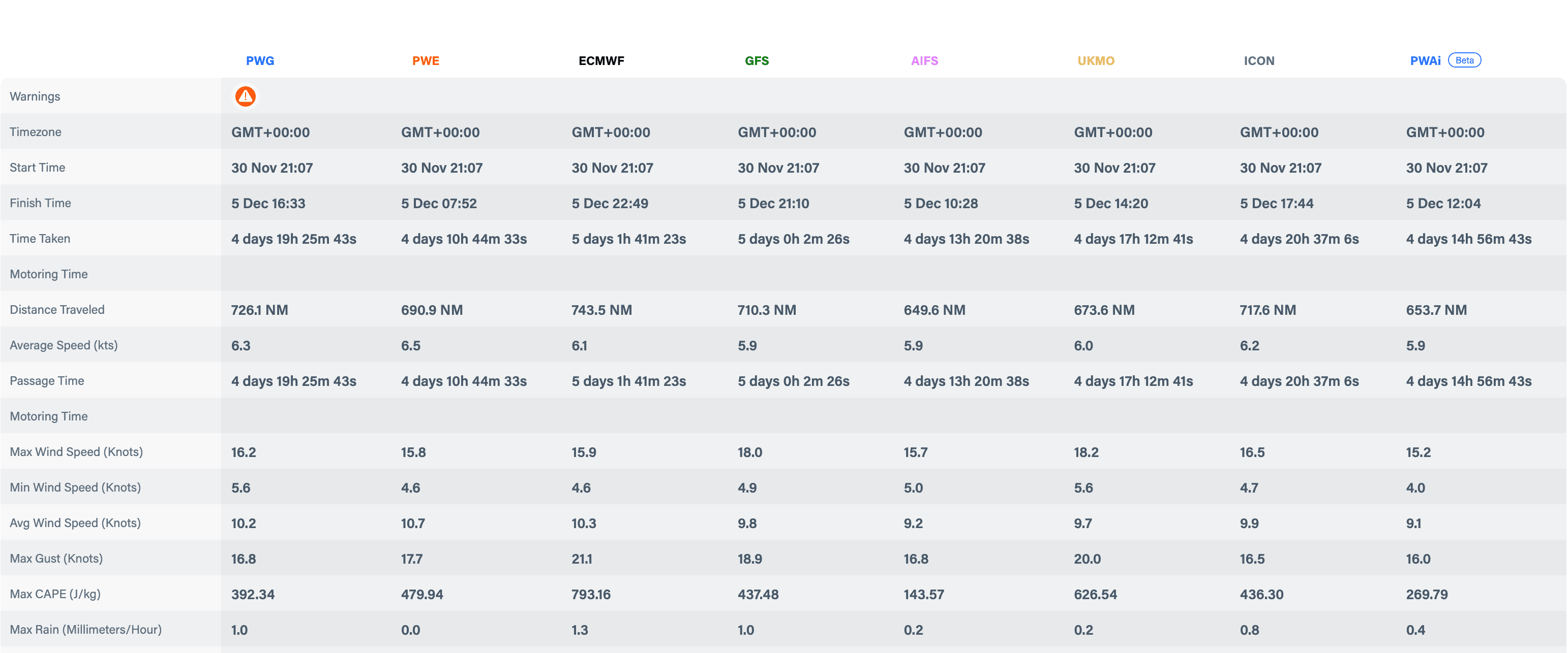
Know what weather is ahead
See the average, maximum, and minimum wind speeds, wave height, direction and period, ocean currents, cape and rain that you’ll encounter on your route. Also view extreme weather warnings if conditions are unsafe for sailing.