Catch the best fishing conditions.
Accurate weather forecasts and alerts let you know when conditions will be perfect so you can get you on the fish, quick.

Join 1 Million+ marine users worldwide

David Weaver
ZenZak Fishing Charters
“To date it’s been the most reliable weather forecast.”

Milan Radonich
Big Angry Fish TV Show
“We run our business by it, as it’s very accurate. It’s paid for itself 10 times over for us. ”

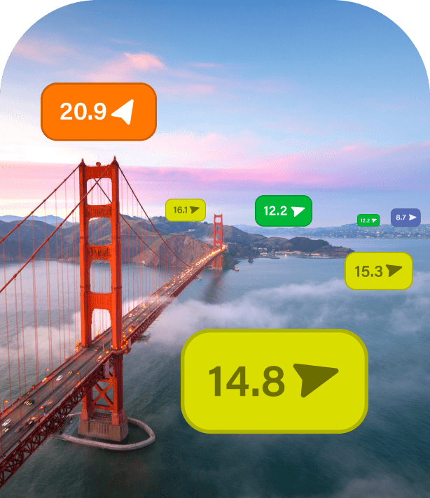
Hi-res Maps
Experience unrivalled accuracy and detail like never before. Select from our extensive range of forecasts below.
ECMWF
UKMO
GFS
SPIRE
PWG
PWE
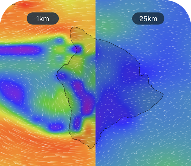
Unrivalled detail
High Resolution GRIB files give you maximum detail down to an incredible 1km resolution. At this level, thermal and land effects are visible like never before.Find out more

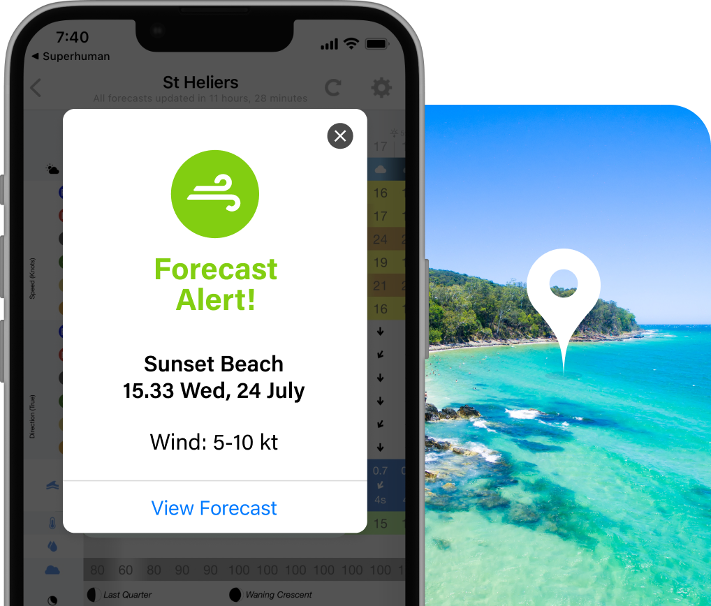
Get notified when conditions are perfect
Set your preferences and relax. We’ll send you Alerts when conditions are just the way you like them.Find out more
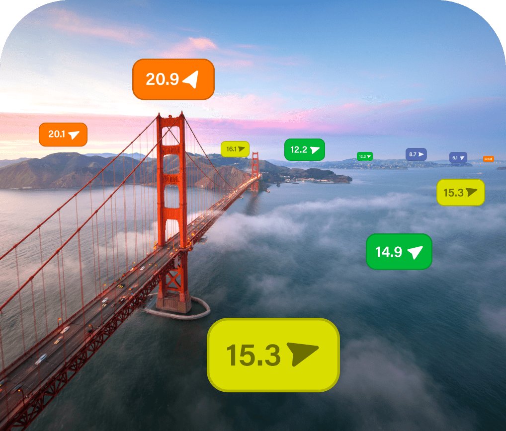
Know before you head out
See what’s happening right now on the water with over 20,000 live weather Observations.Find out more
Learn from the locals
Hear about the best spots, amenities and activities at your destination, from the locals, using Local Knowledge.Find out more


Pricing
and Subscriptions
Three month satisfaction guarantee or your money back!
Yearly
3 Monthly

"To date it’s been the most reliable weather forecast."
David Weaver
ZenZak Fishing Charters

"We run our business by it, as it’s very accurate. It’s paid for itself 10 times over for us. "
Milan Radonich
Big Angry Fish TV Show
Please reach out to our Support team or visit the Help Centre if you have any questions.
ProductsIridium PhonesPredictWind AppOffshore AppClothingIridium GO! execIridium GO!DataHubYB3iGRIB FilesSIM CardsSIM Airtime PlansAnyApp DataActivate SIM/DevicePredictMailPredictChatStarlinkOver the Horizon AIS
FeaturesWeather RoutingPower RoutingDeparture PlanningCurrent ModelsGPS TrackingMapsDaily BriefingGraphs/TablesWeather ModelsAlertsObservationsLocal KnowledgeValidationAIS DataAI Polars
Products
Features
Choose your Activity
Support