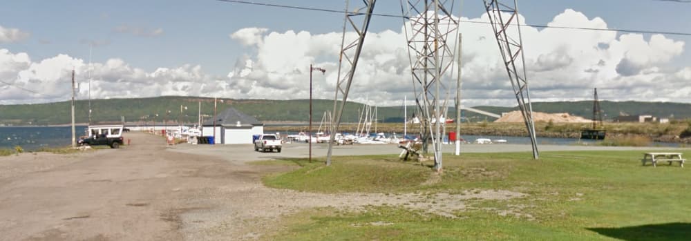
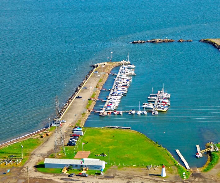
About Dalhousie Regional Marina
The marina is situated at 111 Rock Island Road, Dalhousie, NB, with coordinates approximately 48° 3' 56.77'' N, 66° 22' 58.26'' W. Facilities and Services: Docking: The marina has berths for various vessel sizes, with a maximum length of 50 feet and a minimum depth of 5 feet. Utilities: Water, electricity (20A and 30A), fuel (gasoline and diesel), and ice are available. Amenities: Restrooms, showers, Wi-Fi, and laundry facilities are provided for visitors. Technical Support: Services like waste disposal, sludge pumps, and used oil recycling are available. There’s also a shipyard, crane, and travel lift for maintenance needs. Accessibility: The marina is equipped with a launching ramp for easy access. Navigation: The approach to the marina is marked by the EX 7 buoy northwest of the harbor entrance, ensuring safe navigation. Nearby Attractions: The marina is close to restaurants, shops, and scenic spots, making it a great base for exploring the natural beauty and cultural richness of New Brunswick. Contact Information: For inquiries, you can reach the marina at 506-684-5298. Dalhousie Regional Marina is known for its picturesque surroundings and friendly staff, making it a welcoming spot for both amateur and experienced sailors. Dalhousie Regional Marina is listed as a marine Telephone Reporting Site (TRS) by the Canada Border Services Agency (CBSA). This means it serves as a designated Port of Entry for private pleasure craft. Vessel operators arriving at the marina must report their arrival to CBSA by telephone unless directed otherwise by an officer. https://www.cbsa-asfc.gc.ca/do-rb/services/trsm-sdtm-eng.html?form=MG0AV3&form=MG0AV3

Comodidades
Port Information
Telefone
Berth Sizes
Profundidade na MLW
Manobrabilidade
Channel Marking
Porto de entrada
Overseas Visitor Berths
Tipo de doca
Style Side To
Style Stern To
Tidal Flow
Active Winter
Weather Forecast
 E 8–11 knots.
 16 to 21°C
 Cloudy
- E 10 knots decreasing to 6 knots. Gusts up to 16 knots.
- 15 to 21°C
 UV Index: 1 - Low
- Chance of showers
- E 7 knots decreasing to 4 knots.
- 13 to 16°C
- UV Index: 0 - Low
- Cloudy